
 DVSA recently announced that they were preparing the L-test to take a ‘real world’ route and that the route will, in part, be defined by Satellite Navigation (sat nav).
It is just a trial, after the trial a full consultation would have to take place before any long term changes were introduced. However, it seems a number of ADIs are not happy with the story so far and with the introduction of sat nav to the driving test. So let me try and put a few minds at rest.
The test is not changing now. No instructor has to teach their pupil to use sat nav, although more of that later, no pupil has to use sat nav on their driving test. A relatively small number of test centres have been selected across Great Britain 20 centres out of a total of around 340. At those centres ADIs may submit candidates for test either under the existing system or for the test format being trialled. A pass under the new system will be just as valid as a pass under the current system.
So if you want to assist in the trial and if you want you and your pupils to be involved and if you use one of the centres where the trials are taking place I would urge you to sign up and be part of investigating the future of driving tests.
As the MSA chairman Peter Harvey said
“The use of a sat nav is a major technological change and the introduction of a sat nav to the driving test is an important addition and reflects modern driving habits. It is important the industry doesn’t stick its head in the sand and ignore changes in society and how technology is changing the way we drive.”
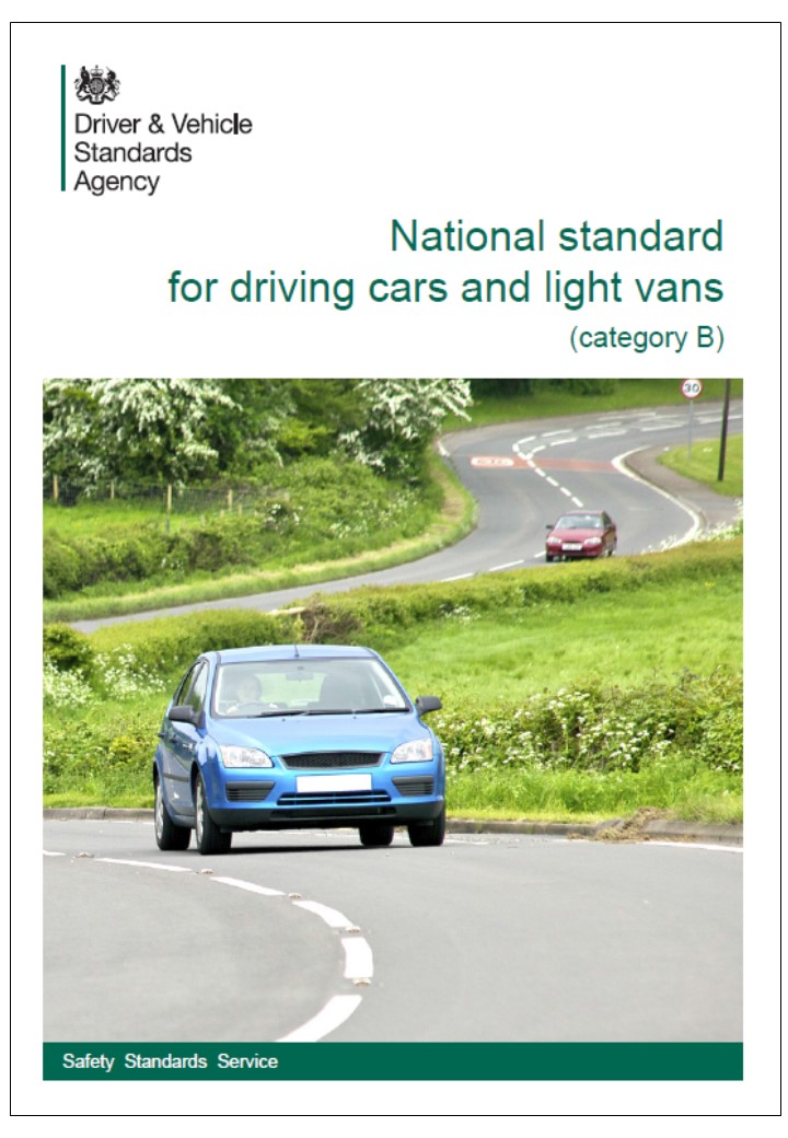
Of course for some, perhaps many, change is always a bit scary in truth all learner drivers should already be taught all details of the use of sat nav devices. The National standard for driving cars and light vans (category B) which we should all be teaching – providing we can find learners willing and able to pay for training across the full syllabus – includes a number of references to the use of sat nav including that Category B drivers must be able to:
- monitor and respond appropriately to instructions provided by satellite navigation systems without being distracted from the driving task
- check that any ancillary equipment (such as after-market satellite navigation systems or ‘head-up’ displays) is legal to use in the vehicle and securely fitted in a position that minimises distraction to the driver
Amongst the things that drivers must know and understand are:
- when using satellite navigation systems, how to program them the information they can provide that they can sometimes fail, and how to prepare for that happening
- that you must always act on the basis of what is in front of you and not just rely on the information provided by satellite navigation systems or other aids
- factors that can distract the driver (such as talking to passengers or using a satellite navigation system) and how to manage them so that you are aware of the driving space and possible hazards when using satellite navigation systems, how to program them the information they can provide that they can sometimes fail, and how to prepare for that happening
- that you must always act on the basis of what is in front of you and not just rely on the information provided by satellite navigation systems or other aids
- factors that can distract the driver (such as talking to passengers or using a satellite navigation system) and how to manage them so that you are aware of the driving space and possible hazards
A footnote contained in the standard states: The DVSA is aware that satellite navigation systems can take a variety of forms; integrated, freestanding/post-market or smartphone app. The technology is also evolving rapidly. The use of the phrase ‘satellite navigation system’ in this standard is taken to mean any electronic device, of whatever format, that is used as an aid to navigation.
The National Occupational Standards (NOS) for driving also includes demands that drivers should plan the route, they need to know and understand: how to use route planning resources and know their limitations.
So it’s over to you to sat nav or not it’s up to you – to sat nav on test you will need to be in one of the trial areas.
 On an historical note the Electro Gyro-Cator (see right) developed in the early nineteen eighties is said to be the world’s first automated commercially available automotive navigation system. Unlike most navigation systems of today, it did not use GPS Satellites to maintain its position and discern movement of the vehicle. Rather, it contained a helium gas gyroscope that could detect both rotation and movement. A special servo gear was also attached to the transmission housing to feed information to the Gyro-Cator to help maintain position, map speed and distance travelled. Transparent maps were placed inside the unit and it would scroll them past a 6″ monochrome Cathode ray tube (CRT) illuminated screen as the car travelled along. The monitor would indicate by a series of circles (or cross hairs) on the screen to show the current location or display lines for path of travel.
Ten years later and a number of gps systems were being developed. Magellan, a GPS navigation system manufacturer, claims to have created the first GPS-based vehicle navigation system in the U.S. in 1995. In the same year a device called “Mobile Assistant” produced by Munich-based company ComRoad AG, won the title “Best Product in Mobile Computing”. It offered turn-by-turn navigation via wireless internet connection, with both GPS and speed sensor in the car.
Be First to Comment